
Confused by the term “geocode” and wondering what it means? It is a unique identifier for any geographic location on Earth, a single code that points to one exact place.
This guide walks through every aspect of geocodes, from what the term means to how geocoding works and the many places the technique is put to use.
Key Takeaways
- A geocode is a unique identifier for any geographic location on Earth.
- Geocodes convert addresses or descriptions into specific coordinates that can be used for mapping and analysis.
- Types of geocodes include address geocodes, entity geocodes, ZIP code geocodes, reverse geocoding, batch geocoding, and interactive geocoding.
- Geocoding accuracy levels vary from ZIP+4 to interpolated to parcel centroid to rooftop coordinates.
- Geocoding is applied in marketing, insurance risk assessment, and telecommunications.
- Tools like Google Geocoder produce accurate and reliable geocoding results.
- Good reference data matters for precise and consistent geocode results.
Understanding Geocodes
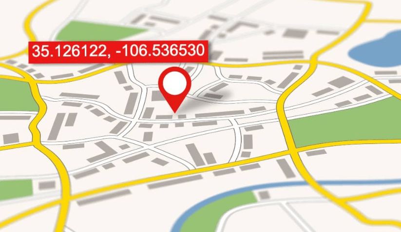
Geocodes are identifiers that distinguish a specific geographic entity by converting its description into a set of coordinates.
Definition of geocodes
A geocode is a unique code for a place or thing on Earth. It helps tell one spot apart from the many others around it. An address or the name of a place, for example, can turn into a single point on a map through geocoding.
Converting descriptions into geographic codes lets us use and study location data far more easily. It gives maps and other tools a plain, consistent way to understand where places are. In effect, a geocode works like a fingerprint for each part of the world, setting one location clearly apart from the rest.
Types of geocodes
Geocodes come in several forms. Here they are.
- Address geocode: turns a place’s address into latitude and longitude.
- Entity geocode: stands for a spot or item on Earth.
- ZIP code geocode: reflects how the U.S. Postal Service routes mail.
- Reverse geocode: changes coordinates back into an address or place name.
- Batch geocoding: converts many single-line addresses into geographic data at once.
- Interactive geocoding: lets users pick the best match from several options when the location details are uncertain.
How Geocoding Works
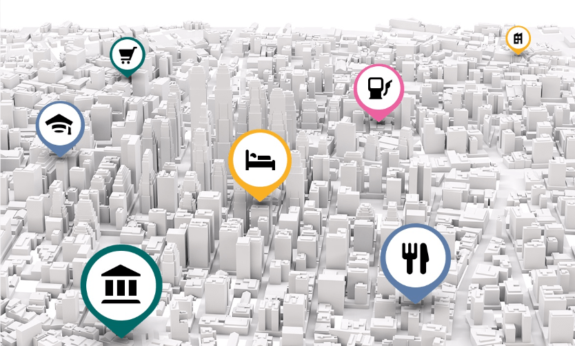
Geocoding converts text-based descriptions of locations into geographic coordinates, such as latitude and longitude.
Process of converting descriptions to coordinates
Making a geocode from words is straightforward. Here are the steps.
- Start with the text of a place.
- Those words can be an address or a place name.
- Feed them into a dedicated tool, which may be an online service or software.
- The tool scans its data to match the words with a place on Earth.
- Sometimes it returns more than one match for the same words.
- Pick the correct match from those options.
- The words are now turned into numbers called coordinates.
- Those numbers tell you where on Earth the place sits.
Importance of reference data
Reference data plays a crucial role in geocoding because it supplies the accurate, reliable information needed for identifying and locating places. When converting descriptions into coordinates, geocoding algorithms rely on this reference data to match addresses or place names with their corresponding geographic locations.
This keeps the resulting coordinates precise and lets them be used effectively in mapping, analysis, and decision-making. Good reference data includes up-to-date address databases, detailed maps, and thorough geographic information systems (GIS) datasets that the algorithm can check against.
By drawing on high-quality reference data, geocoding services return more accurate results, which in turn supports better insights and outcomes across fields such as transportation planning, marketing strategies, emergency services response planning, and urban development decisions.
Accuracy of Geocoding
Geocoding offers different levels of accuracy, such as ZIP+4, interpolated, parcel centroid, and rooftop coordinates.
Different levels of accuracy (ZIP+4, interpolated, parcel centroid, rooftop)
Geocoding accuracy matters across applications like marketing, urban planning, and emergency services. The levels include ZIP+4, interpolated, parcel centroid, and rooftop. Each has its own characteristics, use cases, and precision.
| Level of Accuracy | Description |
|---|---|
| ZIP+4 | This is the lowest level of geocoding accuracy. It uses postal codes to identify a specific geographic segment within the 5-digit postal delivery area. |
| Interpolated | Interpolated geocoding estimates the specific location by using surrounding known locations. It is useful when exact location information is not available. |
| Parcel Centroid | This level assigns geographic coordinates to the center of a property parcel. It is more precise than ZIP+4 and interpolated, but less accurate than rooftop geocoding. |
| Rooftop | This is the highest level of geocoding accuracy. It assigns geographic coordinates to the exact rooftop of a building. It is the most accurate level and provides the most precise analysis for GIS applications. |
The right accuracy level depends on what the application needs and on the reference data available. Rooftop geocoding suits emergency services, for instance, while ZIP+4 can be enough for some marketing purposes.
Applications of Geocoding
Geocoding has a wide range of applications across many industries. In marketing and advertising, it helps target specific demographics. It also plays a part in insurance risk assessment by identifying areas prone to natural disasters or high crime rates.
On top of that, telecommunications companies use geocoding to track network coverage and plan where to provide service. The sections below look more closely at each of these uses and how geocoding can benefit a business.
Marketing and advertising
Geocoding plays a real part in marketing and advertising. It helps businesses target specific locations by converting addresses into geographic coordinates. With that information in hand, companies can analyze customer data, visualize sales patterns, and build targeted marketing campaigns.
Geocoding can pinpoint areas with a high number of potential customers or help deliver location-based advertisements to specific regions. Bringing it into their strategies lets businesses make smarter decisions about where to focus their marketing effort and better understand their target audience’s geographic preferences.
Insurance risk assessment
Insurance companies often apply geocoding as part of their risk assessment processes. By geocoding, they can accurately pin down the location of insured properties and weigh the potential risks tied to them.
An insurer can, for example, analyze crime rates, flood zones, and fire hazards against specific geographic coordinates to gauge the level of risk.
That informs how they set appropriate premiums for policies and make decisions about coverage. Geocoding feeds the risk assessment process with valuable detail on the geographic factors that can affect a property’s safety and security.
Telecommunications
Telecommunications is another field that gains from geocoding. Converting addresses or place names into geographic coordinates lets these companies locate their infrastructure and run services more efficiently.
Geocoding helps plan and guide where to place cell towers, antennas, and communication lines. It also enables precise routing for phone calls and data transmission. In emergency services, it plays a part in locating distressed callers or pinpointing the source of network issues.
With geocoding technology in place, telecommunications companies can widen their network coverage, improve connectivity, and deliver better service to their customers.
How to Use Geocoding
To geocode, you can use tools such as the Google Geocoder, which converts addresses into geographic coordinates. Accurate, up-to-date reference data gives the best results when you run address locators for geocoding.
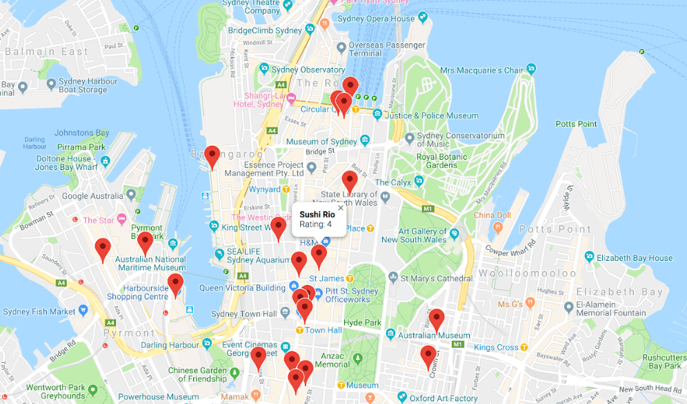
Tools like Google Geocoder
Google Geocoder is a widely used geocoding tool. It converts addresses or place names into geographic coordinates, such as latitude and longitude. Enter an address and it returns the exact location on a map.
The tool is widely used because it returns accurate results and is easy to work with. Good reference data still matters with tools like this one, since it is what keeps the results accurate and reliable in the first place.
Importance of good reference data
Good reference data is central to accurate geocoding. When a location description is converted into a set of geographic coordinates, the quality of the reference data used plays a large part in determining how accurate the result turns out to be.
Having reliable and up-to-date reference data on hand keeps the geocoding process precise and cuts down on the number of errors.
With good reference data behind them, geocoding tools can match addresses or place names much more accurately, resulting in correct latitude and longitude coordinates. This matters because inaccurate geocodes can misidentify locations on maps or hand users the wrong information about where a place actually is.
On top of that, good reference data helps keep results consistent across different mapping systems and applications. It supports smooth integration with other datasets and enables a better analysis of geographic information overall.
Introduction to address locators
Address locators are an essential part of geocoding. They help convert textual descriptions, such as addresses or place names, into specific locations on a map using geographic coordinates.
Address locators play a role in mapping and spatial analysis by turning address information into physical coordinates that can be analyzed and understood. This matters because it lets us structure location data and put it to work for purposes such as transportation planning, urban development, marketing strategies, and emergency services.
By combining address locators with geocoding techniques, organizations can make informed decisions based on accurate spatial information.
Conclusion
In short, a geocode is a specific code that represents a particular location on the Earth’s surface. It converts addresses or descriptions into precise coordinates that can be used for mapping and analysis.
Geocoding serves a role in many different fields, making it easier to read spatial patterns and helping people make informed decisions based on location information.
Frequently Asked Questions
What is a geocode?
A geocode is a set of coordinates (latitude and longitude) that represents a specific location on Earth.
How is a geocode used?
Geocodes are used in mapping and navigation systems to pinpoint locations on maps, track routes, calculate distances, and provide directions.
Where can I find the geocode for a specific address?
You can find the geocode for a specific address by using online mapping services like Google Maps or by using dedicated geocoding websites or APIs.
Can I use geocodes to find nearby places or businesses?
Yes, you can use geocodes to search for nearby places or businesses within a certain radius of your chosen location using mapping applications.
Is there any cost associated with obtaining or using geocodes?
The cost of obtaining or using geocodes depends on the service provider. Some providers offer free access to basic services, while others may require payment for more advanced features or higher usage levels.

- Independent picks for exactly what you just read about
- Matched to your team size & needs
- Vendors don't pay for placement
Step 1 of 4
How big is your team?
We tailor recommendations to companies your size.














Related Articles
Buyers guide
Twilio Alternatives 2026: 6 Compared and What They Cost
Continue reading →
IT Management
RMM Software: 25 Tools Ranked by 1,843 Reviews
Continue reading →

Buyers guide
How To Choose The Best Freelance Platforms For 2026
Continue reading →

Best Tools
SaveFrom.net: Norton Clears It, the Ads Are the Risk
Continue reading →