7.3
SpotScore
Geoconcept GIS Review: Is It The Right Geographic Information System Software For Your Team?
Best for SMB teams · Mid-market · Enterprise
Add to compare
Geoconcept GIS offers custom pricing plan
 Carrefour
Trusted by teams including Carrefour
Overview
Pricing
Features
Buyer feedback
Alternatives
Customers
Media
Security & Compliance
Support
FAQ
Blogs
What is Geoconcept GIS?
The interactive geospatial solution, Geoconcept GIS, is tailored to businesses and provides optimization tools for professionals.This robust, French-built software enables the creation of detailed, collaborative maps for improved communication and decision-making.Geoconcept GIS is a robust mapping tool that offers an efficient and easy user experience to help take the guesswork out of geographical optimization.
Pricing
Geoconcept GIS offers custom pricing plan
Best For
Suited for small teams, SMBs, and enterprise
Security & Compliance
Data residency:🇪🇺
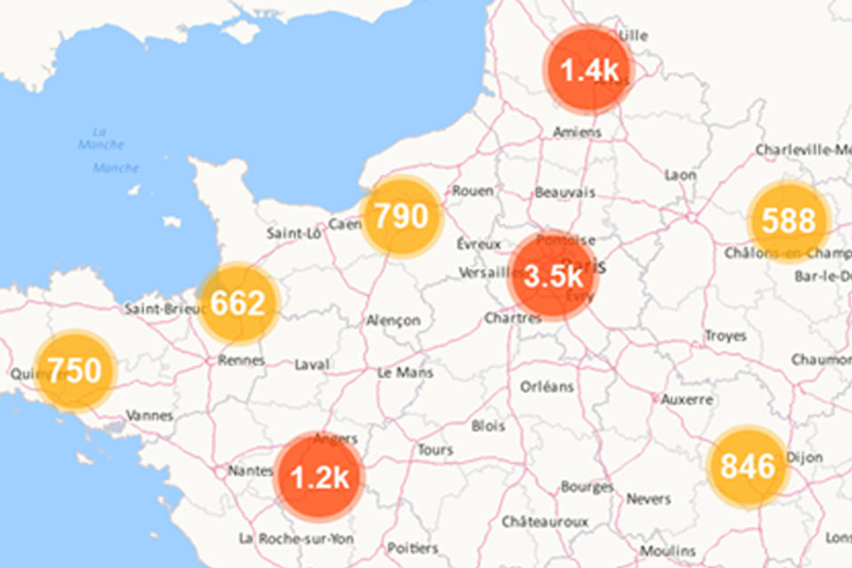
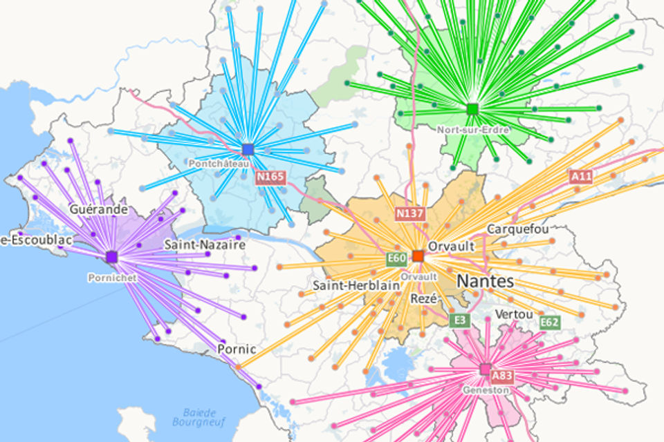
Geoconcept GIS Screenshots

Geoconcept GIS was reviewed internally using user feedback, in-house testing, and market research to assess its performance, reliability, and user experience. Learn how we review products and our evaluation process.

Who should consider Geoconcept GIS
- Team types
- Large Enterprises, Medium Business
Why teams choose Geoconcept GIS
Provides detailed mapping and optimization tools.
Facilitates collaboration among team members effectively.
User-friendly interface enhances accessibility.
Is Geoconcept GIS right for you?
What buyers should know before shortlisting Geoconcept GIS
Geoconcept GIS is a robust mapping tool tailored for businesses, offering optimization features that enhance decision-making. Its collaborative capabilities make it an excellent choice for teams working on geospatial projects.
Geoconcept GIS pros and cons
- Geoconcept GIS pros
Provides detailed mapping and optimization tools.
Facilitates collaboration among team members effectively.
User-friendly interface enhances accessibility.
- Geoconcept GIS cons
May be complex for users without GIS experience.
Limited support for non-French users could be a barrier.
Ready to try it?
Get started with Geoconcept GIS
Connect with the team for a personalised demo.
Still comparing?
See how it stacks up
Compare Geoconcept GIS side-by-side with top Geographic Information System Software alternatives.
What is the pricing of Geoconcept GIS?
Geoconcept GIS uses custom pricing — plans are tailored to your team size and needs. Contact them for a quote.
Geoconcept GIS Pricing Plans
Weighing your options?
Not sure if Geoconcept GIS fits your budget?
Geoconcept GIS reviews and ratings
What buyers like
- Interactive geospatial solutions
- Collaboration tools
- Optimization features
Common complaints
- Limited support for non-French users
- Can be complex for beginners
- Subscription costs may be high
Be the first to review Geoconcept GIS
You'll help thousands of buyers make a smarter decision.

- See if Geoconcept GIS fits your business
- Real pricing — no sales pressure
- A demo or quick answers, your call
Step 1 of 4
How big is your team?
We tailor recommendations to companies your size.


What are the features of Geoconcept GIS?
Geocoding is a powerful software feature that helps users obtain precise location data by converting a physical address into geographic coor…
Image management is a crucial aspect of any software that deals with digital images. It refers to the process of organizing, storing, and re…
Interoperability is a key feature of software that allows different systems to communicate and share data with each other seamlessly. It ena…
Labeling is a software feature that enables the user to organize and categorize different items or data within the software. This feature is…
Spatial analysis is a key feature that is used in various software programs to analyze and interpret data in the geographical context. It en…
Geoconcept GIS security and data handling
Key compliance certifications and security features for IT and security teams evaluating Geoconcept GIS.
Certifications

Developer & data
Alternatives to Geoconcept GIS
Geoconcept GIS Customers
Carrefour
Air Liquide
acr group
AIRRIA
Allodiagnostic
BERNER
Geoconcept GIS Support Options
Frequently Asked Questions About Geoconcept GIS
Common questions buyers ask before choosing Geoconcept GIS.
Geoconcept GIS is a Geographic Information System Software. Geoconcept GIS offers Spatial Analysis, Labeling, Interoperability, Image Management and many more functionalities.
Buyers commonly note the following limitations of Geoconcept GIS: May be complex for users without GIS experience.; Limited support for non-French users could be a barrier.; Subscription costs can be high for small teams..
Some top alternatives to Geoconcept GIS includes CARTO, eSpatial, ArcGIS Online, Mapbox and Mapify.
Geoconcept GIS offers Quotation Based pricing model
The starting price is not disclosed by Geoconcept GIS. You can visit Geoconcept GIS pricing page to get the latest pricing.
Ready to try it?
Get started with Geoconcept GIS
Get connected with the team for a personalised demo.
About the reviewer
Rajat Gupta is the founder of Spotsaas. Over the past two years, he has reviewed 2,000+ tools across CRM, HR, AI, and finance — applying hands-on product research and a background in commerce and the CFA program to evaluate software through a business and ROI lens. His goal: help teams make software decisions they won't regret.
Disclaimer: This research has been collated from a variety of authoritative sources. We welcome your feedback at [email protected].